History of Ober-Werbe

The name of the place Ober-Werbe comes from "Werva", i.e. on Latin vortex or gyroscope water. The name is derived from the brook "the advertising". For the first time Ober-Werbe 935 A.D. is mentioned documentary.


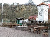
The village is appropriate for the Edersee in a beautiful valley between basket oh and, surrounded by forests. The gemarkung covers 603 hectars (Ober-Werbe 315 hectars, waiter Werba 288 hectars). At present Ober-Werbe counts 204 inhabitants and is a quarter of the greater forest-hits a corner. The place lived predominantly on the agriculture. In addition, there is a schmiede and a carpenter's workshop. The today's place is at 31.12.1970 by freiwilligen the union of the municipalities Ober-Werbe (circle forest-hit a corner) and Oberwerba (circle Franconia mountain) developed. one tried 1953 like in former times in vain to unite the two municipalities. This attempt failed however because of different financial circumstances of the two places (Oberwerba was more forest-rich). The division in two parts of the village and the gemarkung took nearly 400 years (1590 to 1970)


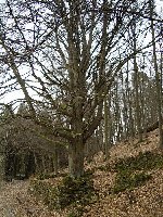
In Ober-Werbe rare plants, z grow. Ex. the dreizaehnige knabenkraut. This herb grows at the monastery mountain because of the Kalkhaltigen of soil on half drying lawns. The dreizaehnige knabenkraut to the Orchideen, one finds it belonged in the Waldecker country only with Lengefeld. (see also long stone)


Since newest the entire monastery mountain was explained as the landscape protection area. Thus the rare plants are to be protected.


The children of the village went until 1910 into different schools, from 1910-1965 visited them the common school into Oberwerba. From 1965 to 1971 they went visiting the school children the center school Saxonia living to the center school Voehl and since 1971.


The two municipalities were also church separate until 1937. Ober-Werbe belonged to Saxonia living and Oberwerba was its own church municipality in the Kirchspiel Basdorf Oberwerba.


The modernization of Ober-Werbe

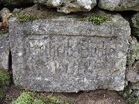
The oldest still standing house in Ober-Werbe was built around 1781. The old houses carry partially still house inscriptions. Until 1910 there were even two schools. Afterwards the schoolable children went into the school to waiter Werba. Between the two places (Ober-Werbe and Oberwerba) there were schneeballschlachten again and again.


1882 were finished the first bridge between the places. The telephone connection came approx. 1915. First there was only one telephone in Ober-Werbe. The owner of house, who got the connection, had to convey the messages in the village.


In Oberwerba for the first time electrical light burned on 17 December 1917. The farmers had first resisted. They had fear that the river could set their houses in fire. First there was one power source in a house only, later the lines also to other rooms was usually put. At the beginning the river was needed only for the sources of light, electrical devices was hardly present at the time and kept also slow in the future introduction only very.


The water pipelines were put 1927. Over one began 1935 with it, the roads into and around Ober-Werbe to tars. The only well removed road leads after Saxonia living.


The playground was put on 1971-1972.


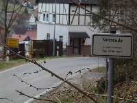
  Whether with this sign the Handyempfang is meant probably in Ober-Werbe? The mobile receipt in Ober-Werbe is anyhow very bad.


Number of inhabitants and office affiliation of Ober-Werbe
(1927 district court bath Wildungen, tax office Corbach)
119 inhabitants (1925)
118 inhabitants (1939)

From history of the principality forest-hit a corner

District circle of the Eder

Affiliation nationally : Country forest-hit a corner,
starting from 1929 Prussia, province Hessen Nassau, governmental district Kassel
Zustaend. Law (1894) :
1) district court bath Wildungen, regional court Kassel, higher regional court Kassel
2) district court Niederwildungen, regional court Kassel, higher regional court Kassel
Zustaend. Law (1927) : District courts bath Wildungen, basket oh, regional court Kassel, higher regional court Kassel
Zustaend. Gau 1933-45 : Cure Hessen
Affiliation ev. Church : Evangelist regional church cure-Hessen-forest-hit a corner
Affiliation kath. Church : Diocese Fulda

Country forest-hit a corner
(since 1. 1. 1868 by Prussia administer, 1918 Free State, 1929 part of the Prussian province Hessen Nassau)


The princes of the principality forest-hit a corner and Pyrmont
1845 - 1893 George Viktor (1831 - 1893)
1893 - 1918 Friedrich (1865 - 1946)


The Prussian national directors 1918 - 1929
1918 - 1. 9. 1920 of shipowners
1. 9. 1920 - 7. 2. 1929 Dr. Schmieding
25. 2. - 1. 4. 1929 Herberg


Number of inhabitants country forest-hit a corner
56.224 (1871)
54.743 (1875)
56.522 (1880)
57.918 (1900)
59.127 (1905)
61.707 (1910)
55.816 (1925)

Denomination structure country forest-hit a corner

Denomination 1871 1880 1890 1900 1910
Evangelist 96,14 % 95,53 % 95,50 % 95,46 % 93,69 %
Roman-catholic 2,32 % 2,79 % 2,90 % 3,16 % 4,63 %
Other Christians 0,05 % 0,12 % 0,28 % 0,28 % 0,64 %
Jew 1,48 % 1,51 % 1,32 % 1,10 % 0,96 %
Without indication - - - 0,00 % 0,07 %


Denomination structure country forest-hit a corner 1925

I. Christian altogether 54.983 98,51 %
A. Evangelist Christians altogether 52.650 94,33 %
A.1. Belonging one of Evangelist regional churches 51.985 93,14 %
A.2. Belonging one of Evangelist free churches 376 0,67 %
A.3. Baptisten 163 0,29 %
A.4. Neuapostoli 80 0,14 %
A.5. Adventisten 6 0,01 %
B. Roman-catholic inclusively. unierte rites 2.286 4,10 %
C Orthodoxe Christian 6 0,01 %
D Altkatholiken and used church societies 3 0,00 %
E. Other Christians 38 0,07 %
II. Jew 477 0,85 %
III. Other not-Christian religions 0 0,0 %
IV. Belonging one of other world-descriptive communities 101 0,18 %
V. Faith lots 120 0,21 %
VI. Without indication 135 0,24 %


The realm tag elections of
in the principality forest-hit a corner
1907 1912
Nationalliberally 12,3 % 17,4 %
Economic combination 36,3 % 37,5 %
Freeintimate combination 41,3 % -
Progressive people's party - 31,4 %
SPD 10,0 % 13,7 %
Splintered 0,1 % 0,0


National description 1894
" forest-hit a corner , principality (1121 qkm = 20.36 square meter), 57.281 Ew., of it 54.704 Evang., 1658 Kath. and 753 Jews; on 1 qkm), is appropriate for 51 Ew. with his main part between Hessen Nassau and Westphalia to the Diemel, twiste, Eder and Orke and with a small part (Pyrmont) suedl. v. Hameln to the Emmer. The Laendchen is quite gebirgig, in the main part, where slate and new red sandstone mountains collide, often very rough and reached whole in the SW., in the source area of the Diemel, a height of 800 m (Ettelsberg suedwestl. v. Willingen 837 m). From the total area are allotted to field and gardens 43.4 Proz., meadows 8.0, pastures 6.4 and felling trees 37.9 Proz. The viehzaehlung of 1892 resulted in: 6381 horses, 25.602 pieces cattle cattle, 52.566 sheep, 27.469 pigs and 8053 goats; the mining industry 1880: 32.968 clay/tone of iron ores; the trade counting of 1882: 4281 enterprises with 6460 in the same busy persons. The new condition dates of 17. August. 1852, the federal state parliament consist of 15 delegates selected by general indirect choice. The national colors are black, red, yellow. The internal administration is transferred and by a national director is led since 1 January 1868 Prussia. The country disintegrates into the 4 circles of the twiste, the iron mountain, the Eder and Pyrmont; judicially it belongs with the main part to the national court district Kassel, with Pyrmont to from Hanover. The incomes and expenditures are for 1894 on 1,262,112 M. estimated; the debt amounted 1893 to 2,160,000 Mk.. The troops belong to Inf. moving. No. 83rd capital is Arolsen."
(source: Neumann's local encyclopedia of the German Reich. A geographical-statistic reference book for German regional studies. Third, again worked on and increased edition of William wedge. Leipzig, 1894.)